
Gaspésie - the Gaspé Peninsula
Quebec, to the south of the Saint Lawrence
- Explore Quebec ►
- Essential pages
- Places to visit
- Attractions
About-Quebec.com
An incomplete guide to discovering Quebec
An incomplete guide to discovering Quebec
The spectacular eastern tip of Quebec
Key:
 Main
points of
interest - Click markers for more
detail
Main
points of
interest - Click markers for more
detail
Main
points of
interest - Click markers for more
detailWith
its dramatic coasts, small fishing villages and beautiful mountains,
Gaspésie is like no other part of Canada
Once upon a time, many centuries ago, a
large part
of the
northeast Atlantic coast of North America was colonised by people
from France. Along the northeast coastline, there were three French
colonial areas called Acadie, Gaspésie and Terre-Neuve.
In the 18th century, following conflicts and treaties between
warring nations in Europe, Acadie - now part of Maine and New Brunswick
- and Terre-Neuve - now called Newfoundland - came under British
colonial rule. That left Gaspésie as the only
French-speaking
area on the Atlantic coast of continental America.But very few people lived there. The only settlements were fishing villages along the coast, inhabited in part by French settlers from Acadia, and in part by British Loyalists who moved up from the new United States following its independence.
To this day, Gaspésie remains a very sparsely populated area, with a total population of under 100,000 people in an area of a little over 20,000 km² – which is less than 5 people per square kilometer, far less than the neighbouring Atlantic provinces of Nova Scotia and New Brunswick.
The
Gaspésie coastal highway - right on the water's
edge
Essentially, Gaspésie offers two kinds of opportunity; on the one hand the opportunity for a leisurely drive along what is arguably the most scenic coastal route in North America, on a par with California's Highway 1; on the other hand a mountain and National Park area with fabulous hiking and skiing trails through a pristine natural environment.
It is Gaspésie's coastal route that attracts the most visitors: but don't imagine that it attracts the crowds – it doesn't. This is too much of a far-flung destination to attract the hordes, too remote, too far from any big city or from any international airport apart from Quebec. Gaspésie is a destination for conoisseurs, those who have done their homework, those who a ready to seek out the beautiful parts that others have not found. And those who make the journy are duly rewarded.
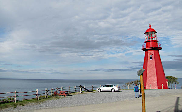
Phare de la Martre, one of
Gaspésie's many iconic lighthouses
Highway 132 follows an amazing route; it actually starts at the Vermont border southwest of Montreal, and follows the south bank of the Saint Lawrence all the way to Gaspé; and at Gaspé, it continues to hug the coast, looping round the southern shores of the Gaspé peninsula and back across the peninsula to reconnect with itself on the northern coast, at Sainte Flavie. Thus you can, if you want, do a tour of Gaspésie by just following the 132 from Sainte Flavie, and round back to Sainte Flavie.
Landing in Gaspésie on the ferry to Matane means that you start your tour about 50 miles northeast of Sainte Flavie.
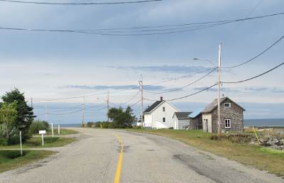
From Matane, highway 132 just follows the coastline; and in this case, "following the coastline" means driving with the sea on one side of the road, and the hills or cliffs on the other. Stop anywhere you want, to wander along deserted beaches, watch the birds, visit a lighthouse, or discover another small fishing village. There is no prescribed list of places to stop, just a succession of views and vistas, landscapes and seascapes.
The largest towns are small, places like Sainte Anne des Monts with another cluster of hotels and a few restaurants. Sainte Anne also has a marine discovery centre, with aquariums and boat trips on the Saint Lawrence.
There's not really a great choice of routes when it comes to visiting Gaspésie. Most visitors will want to drive round the coast following Quebec Route 132 . An alternative is to cut south across the peninsula from Saint-Anne des Monts, taking in the wild and uninhabited mountains of the Gaspé National Park.
The full coastal circuit from Rimouski to Gaspé and back is a distance of 925 kilometres, or 575 miles, with most of the route except the last 100 miles hugging the shoreline - a spectacular journey if ever there was one.
This is one of Canada's iconic road trips, with superb views and miles of unspoilt shoreline. Gaspé, the small town at the western end of the peninsula, is a place whose historic significance goes back almost 500 years, as it was here on July 24, 1534, that French navigator Jacques Cartier declared "New France" as a possession of King François I. South of Gaspé is the most popular area of the coastline, around the spectacular Percé rock and Bonaventure Island.
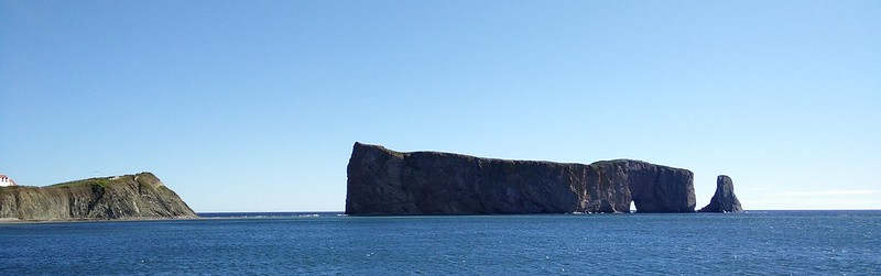
Where Gaspesie ends..... Rocher Percé
Continuing south and west after Percé, the 132 follows the coast of the Baie des Chaleurs, or Bay of warmth. The south-facing beaches along this part of the coast are popular with visitors, but in spite of the name, the water is not always warm. Sea swimming is possible for a few weeks in the year, especially at the western end of the bay, with the areas of Caplan and Carleton sur Mer reportedly having some of the warmest ocean water temperatures in Canada.
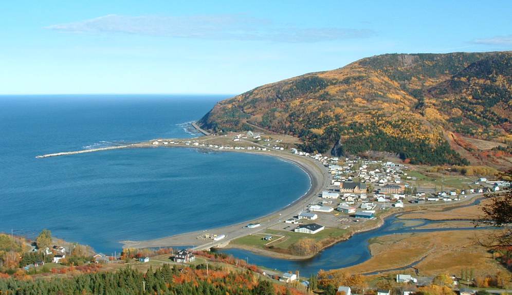
On
the southern shore of the Saint Lawrence, Gaspésie offers small places
to remember, and breathtaking scenery
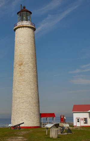
Cap des Rosiers lighthouse, the tallest in Canada
► More pages on About-Quebec.com:
- Skiing and winter sports
- Driving in Quebec
- Quebec city
- The north shore of the Saint Lawrence
- Montreal
Hotels in Gaspésie
Check out best online rates from Booking.com for hotels, motels and guest-houses :No pre-payment on many bookings; pay when you stay; no cancellation fees.
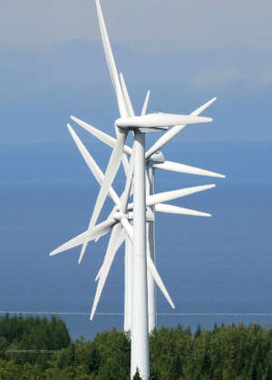
Wind is one of the Gaspésie coast's natural resources
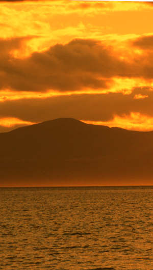
Gaspésie sunset
Discover other countries...
About France - the connoisseur's guide to France. Over 200 pages of information for visitors and students.
About Britain - New; a thematic introduction to Britain
About Spain - discover the real Spain - an incomplete guide to Spain on and off the beaten track
Angleterre.org.uk - Le guide de l'Angleterre, en français
Top photo by Jules Mim.
Cap des Rosiers lighthouse by Adrien A.
Creative commons 3.0 licence.
Rocher Percé by A Picardier
Text and other photos on this page © About-Quebec.com